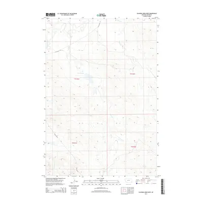
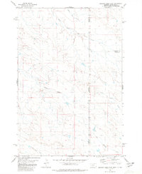
2014 Map of Elkhorn Creek West
USGS Topo · Published 2014About this map
Little Missouri River flows through this corner of Carter County, Montana, carving a drain network that includes Blacktail Cr, Horse Cr, and Elkhorn Cr. The landscape is defined by the high plains topography of the Powder River Basin, where water management is critical to local land use. A significant landmark for water conservation is the J Oliver Reservoir, a man-made feature providing a reliable source in an otherwise semi-arid environment. Access to these remote stretches is provided by thoroughfares like Little Missouri Rd and Indian Creek Rd, which follow the natural contours of the drainage basins. The map illustrates the structured township and range system, specifically noting t7s r61e and t8s r61e, which are essential for property researchers and genealogists tracing ranching history along the Twelvemile Cr drainage.
Find a feature on this map
12 named features on this map. Tap any name to fly to it.
Don’t see what you’re looking for? This feature index may not catch every label — zoom into the map to look around manually.
Map Details
Editions of this 2014 Elkhorn Creek West Map
This is the sole edition of this map. No revisions or reprints were ever made.
Other maps of this area

1954 · Ekalaka
USGS Topo · 1:250,000

1956 · Ekalaka
USGS Topo · 1:250,000

1958 · Ekalaka
USGS Topo · 1:250,000

1965 · Ekalaka
USGS Topo · 1:250,000
1980 · Elkhorn Creek SW
USGS Topo · 1:24,000

1980 · Cactus Creek West
USGS Topo · 1:24,000

1980 · Finger Buttes East
USGS Topo · 1:24,000
1980 · Sevenmile Creek
USGS Topo · 1:24,000
1980 · Albion
USGS Topo · 1:24,000
1980 · Elkhorn Creek East
USGS Topo · 1:24,000