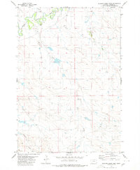
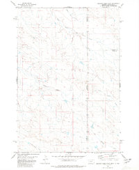
1980 Map of Elkhorn Creek West
USGS Topo · Published 1980About this map
The Little Missouri River meanders through the northwest corner of this Carter County landscape, creating a distinct riparian corridor amidst the surrounding drainage systems. Several prominent seasonal and perennial streams define the local topography, including the southward-flowing Horse Creek and the meandering Elkhorn Creek to the east. These waterways are characteristic of the high plains drainage patterns that feed into the Missouri River basin. In the southern portion of the sheet, Twelvemile Creek and Blacktail Cr mark the lower elevations of the terrain. The map reflects a predominantly rural and open landscape in the late twentieth century, with section lines and drainage basins providing the primary framework for land organization and navigation in this remote section of Montana.
Find a feature on this map
5 named features on this map. Tap any name to fly to it.
Don’t see what you’re looking for? This feature index may not catch every label — zoom into the map to look around manually.
Map Details
Editions of this 1980 Elkhorn Creek West Map
This is the sole edition of this map. No revisions or reprints were ever made.
Other maps of this area

1954 · Ekalaka
USGS Topo · 1:250,000

1956 · Ekalaka
USGS Topo · 1:250,000

1958 · Ekalaka
USGS Topo · 1:250,000

1965 · Ekalaka
USGS Topo · 1:250,000
1980 · Elkhorn Creek SW
USGS Topo · 1:24,000

1980 · Cactus Creek West
USGS Topo · 1:24,000

1980 · Finger Buttes East
USGS Topo · 1:24,000
1980 · Sevenmile Creek
USGS Topo · 1:24,000
1980 · Albion
USGS Topo · 1:24,000
1980 · Elkhorn Creek East
USGS Topo · 1:24,000