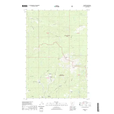
2020 Map of Elkhorn
USGS Topo · Published 2020About this map
Elkhorn sits at the center of this mountain landscape, a focal point for the mining and ranching history of Jefferson County. The terrain is defined by a complex network of drainages and high points, including Elkhorn Peak and Crow Peak, which divide the waters of Prickly Pear Cr from Elkhorn Cr. This area shows clear evidence of its industrial past with the Iron Mine located near Rabbit Gulch, while name-heavy features like Slaughterhouse Gulch and Ninety Cent Gulch suggest the grit of early prospectors. The map reveals how the geography is parsed into the Helena National Forest and Deerlodge National Forest, with significant transportation routes like Diego Town Rd and Tramway Rd providing access to high-altitude meadows such as Turnley Meadows. Collectors and historians can trace the paths through Radersburg Pass or follow the South Fork of Queen Gulch to understand the local settlement patterns of the era.
Find a feature on this map
55 named features on this map. Tap any name to fly to it.
Don’t see what you’re looking for? This feature index may not catch every label — zoom into the map to look around manually.
Map Details
Editions of this 2020 Elkhorn Map
This is the sole edition of this map. No revisions or reprints were ever made.
Other maps of this area

1886 · Fort Logan
USGS Topo · 1:250,000

1889 · Helena
USGS Topo · 1:250,000

1893 · Helena
USGS Topo · 1:250,000

1899 · Boulder
USGS Topo · 1:125,000

1899 · Helena
USGS Topo · 1:250,000

1903 · Helena
USGS Topo · 1:250,000

1947 · Butte
USGS Topo · 1:250,000

1948 · White Sulphur Springs
USGS Topo · 1:250,000

1950 · Devils Fence
USGS Topo · 1:62,500

1950 · Jefferson City
USGS Topo · 1:62,500