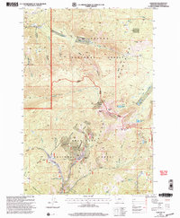
2001 Map of Elkhorn
USGS Topo · Published 2004About this map
The settlement of Elkhorn sits as a high-elevation focal point for the mining history of the Helena National Forest and Deerlodge National Forest. At the turn of the 21st century, the landscape still clearly bears the marks of intense mineral extraction, with numerous workings like the Louise Mine, C & D Mine, and Iron Mine flanking the steep slopes of the Elkhorn Mountains. The presence of a local Cem and names like Slaughterhouse Creek suggest the self-contained nature of this once-booming mining district. High peaks such as Elkhorn Peak and Crow Peak dominate the topography, while the eastern reaches transition toward the Townsend boundary. Water resources are concentrated in the alpine heights, including Tizer Lakes and Hidden Lake, which feed the drainages of Muskrat Creek and Tizer Creek. The area remains defined by its complex network of gulches and high-altitude parks, including Boulder Park and Woods Park.
Find a feature on this map
47 named features on this map. Tap any name to fly to it.
Don’t see what you’re looking for? This feature index may not catch every label — zoom into the map to look around manually.
Map Details
Editions of this 2001 Elkhorn Map
This is the sole edition of this map. No revisions or reprints were ever made.
Other maps of this area

1886 · Fort Logan
USGS Topo · 1:250,000

1889 · Helena
USGS Topo · 1:250,000

1893 · Helena
USGS Topo · 1:250,000

1899 · Boulder
USGS Topo · 1:125,000

1899 · Helena
USGS Topo · 1:250,000

1903 · Helena
USGS Topo · 1:250,000

1947 · Butte
USGS Topo · 1:250,000

1948 · White Sulphur Springs
USGS Topo · 1:250,000

1950 · Devils Fence
USGS Topo · 1:62,500

1950 · Jefferson City
USGS Topo · 1:62,500