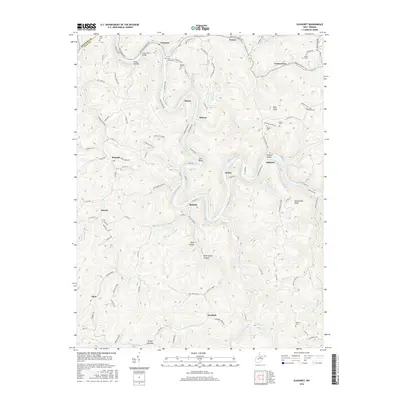
2016 Map of Elkhurst
USGS Topo · Published 2016About this map
The Elk River carves a deep, winding course through this Clay County landscape, creating dramatic bends such as Jack Bend and providing the central axis for early Appalachian settlements. Smaller communities like Elkhurst, Dorfee, and Procious are linked by riverside roads and mountain gaps, while the surrounding ridges are punctuated by peaks like Schoonover Knob and Blue Knob. For genealogists, the map is a dense record of family history, marking numerous upland burial sites including Davis Cem, Pierson Cem, and Mullins Cem. The terrain is defined by a complex network of hollows and forks, such as Toms Hollow and Buckhorn Fork, which reveal the historical patterns of local land use. Transport is concentrated along the narrow river valley, where routes like Procious Maysel Rd and Hartland Rd follow the topography through the heart of the Kanawha and Clay borderlands.
Find a feature on this map
112 named features on this map. Tap any name to fly to it.
Don’t see what you’re looking for? This feature index may not catch every label — zoom into the map to look around manually.
Map Details
Editions of this 2016 Elkhurst Map
This is the sole edition of this map. No revisions or reprints were ever made.
Other maps of this area

1897 · Kanawha Falls
USGS Topo · 1:125,000

1900 · Kanawha Falls
USGS Topo · 1:125,000

1901 · Kanawha Falls
USGS Topo · 1:125,000

1906 · Otter
USGS Topo · 1:62,500

1906 · Walton
USGS Topo · 1:62,500

1907 · Otter
USGS Topo · 1:62,500

1907 · Walton
USGS Topo · 1:62,500

1907 · Clendenin
USGS Topo · 1:62,500

1908 · Clay
USGS Topo · 1:48,000

1909 · Clendenin
USGS Topo · 1:62,500