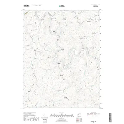
2019 Map of Elkhurst
USGS Topo · Published 2019About this map
The Elk River carves a serpentine path through Clay County, defining the landscape and settlement patterns around Elkhurst and Shelton. In this 2019 survey, the river is documented as the Elk River Water Trail, reflecting its modern recreational use while following the historic corridor that once supported the region's timber and rail industries. The rugged topography is marked by significant elevations like Schoonover Knob and Sycamore Mountain, with smaller communities such as Procious, Odessa, and Glen situated along the narrow valleys and creek beds.
Find a feature on this map
108 named features on this map. Tap any name to fly to it.
Don’t see what you’re looking for? This feature index may not catch every label — zoom into the map to look around manually.
Map Details
Editions of this 2019 Elkhurst Map
This is the sole edition of this map. No revisions or reprints were ever made.
Other maps of this area

1897 · Kanawha Falls
USGS Topo · 1:125,000

1900 · Kanawha Falls
USGS Topo · 1:125,000

1901 · Kanawha Falls
USGS Topo · 1:125,000

1906 · Otter
USGS Topo · 1:62,500

1906 · Walton
USGS Topo · 1:62,500

1907 · Otter
USGS Topo · 1:62,500

1907 · Walton
USGS Topo · 1:62,500

1907 · Clendenin
USGS Topo · 1:62,500

1908 · Clay
USGS Topo · 1:48,000

1909 · Clendenin
USGS Topo · 1:62,500