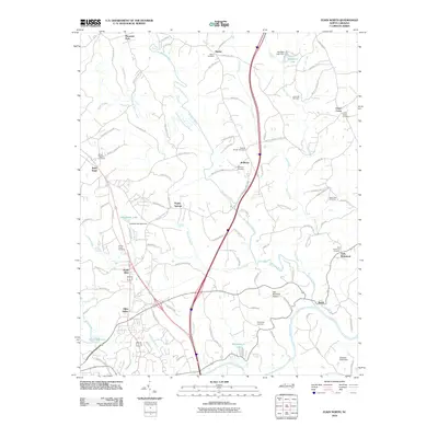
2010 Map of Elkin North
USGS Topo · Published 2010About this map
The Mitchell River and its numerous tributaries, including Turkey Creek and Snow Creek, dominate the rural landscape of this northern North Carolina region. Settlements like Mountain Park, Zephyr, and Little Richmond are connected by a network of local roads that lead toward the more developed corridors near North Elkin. The presence of numerous family and community burial grounds, such as the Snow Hill Cemetery and Friendship Cemetery, suggests a deeply rooted local history tied to the land's agricultural and riverine systems.
Find a feature on this map
110 named features on this map. Tap any name to fly to it.
Don’t see what you’re looking for? This feature index may not catch every label — zoom into the map to look around manually.
Map Details
Editions of this 2010 Elkin North Map
This is the sole edition of this map. No revisions or reprints were ever made.
Other maps of this area

1891 · Yadkinville
USGS Topo · 1:125,000

1893 · Yadkinville
USGS Topo · 1:125,000

1953 · Winston-Salem
USGS Topo · 1:250,000

1955 · Winston-Salem
USGS Topo · 1:250,000

1962 · Winston-Salem
USGS Topo · 1:250,000

1966 · Yadkinville
USGS Topo · 1:24,000

1970 · Copeland
USGS Topo · 1:24,000
1971 · Thurmond
USGS Topo · 1:24,000
1971 · Dobson
USGS Topo · 1:24,000
1971 · Elkin South
USGS Topo · 1:24,000