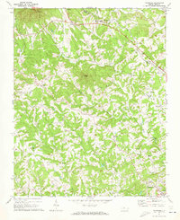
1971 Map of Thurmond
USGS Topo · Published 1973About this map
Thurmond and the rugged divide between Surry Co and Wilkes Co define this 1971 survey of the North Carolina foothills. The landscape is heavily marked by small rural congregations, including Roaring Gap Ch, Sandy Creek Ch, and Little Elkin Ch, reflecting the deep-seated community structures of the era. The terrain transitions from the heights of Wells Knob and White Rock down into a complex drainage system where Elkin Creek and Grassy Creek converge toward the larger town of Elkin in the southeast.
Find a feature on this map
38 named features on this map. Tap any name to fly to it.
Don’t see what you’re looking for? This feature index may not catch every label — zoom into the map to look around manually.
Map Details
Editions of this 1971 Thurmond Map
This is the sole edition of this map. No revisions or reprints were ever made.
Other maps of this area

1889 · Wilkesboro
USGS Topo · 1:125,000

1891 · Wilkesboro
USGS Topo · 1:125,000

1891 · Yadkinville
USGS Topo · 1:125,000

1893 · Yadkinville
USGS Topo · 1:125,000

1953 · Winston-Salem
USGS Topo · 1:250,000

1955 · Winston-Salem
USGS Topo · 1:250,000

1962 · Winston-Salem
USGS Topo · 1:250,000

1966 · Roaring River
USGS Topo · 1:24,000
1968 · Glade Valley
USGS Topo · 1:24,000
1968 · Traphill
USGS Topo · 1:24,000