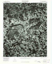
1976 Map of Elkin South
USGS Topo · Published 1979About this map
The Yadkin River serves as the primary geographic corridor on this orthophotoquad, separating the settlements of Elkin and Jonesville. In the mid-1970s, this landscape was defined by a complex mosaic of woodlots and cleared agricultural fields, with development concentrated along the northern riverbank. Small communities like Arlington and Wagoner anchor the surrounding rural areas, while Longtown sits to the southeast.
Find a feature on this map
11 named features on this map. Tap any name to fly to it.
Don’t see what you’re looking for? This feature index may not catch every label — zoom into the map to look around manually.
Map Details
Editions of this 1976 Elkin South Map
This is the sole edition of this map. No revisions or reprints were ever made.
Other maps of this area

1891 · Yadkinville
USGS Topo · 1:125,000

1893 · Yadkinville
USGS Topo · 1:125,000

1953 · Winston-Salem
USGS Topo · 1:250,000

1955 · Winston-Salem
USGS Topo · 1:250,000

1962 · Winston-Salem
USGS Topo · 1:250,000
1966 · Lone Hickory
USGS Topo · 1:24,000

1966 · Yadkinville
USGS Topo · 1:24,000

1970 · Copeland
USGS Topo · 1:24,000
1970 · Brooks Crossroads
USGS Topo · 1:24,000
1971 · Thurmond
USGS Topo · 1:24,000