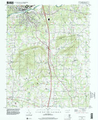
1996 Map of Elkin South
USGS Topo · Published 2000About this map
The Yadkin River serves as the primary geographical divider in this late-20th-century survey, separating Elkin in Surry County from Jonesville and Arlington in Yadkin County. The landscape transitions from the river valley to the prominent elevations of the Brushy Mountains, where peaks like Star Peak, Bald Knob, and Rock House Mountain dominate the central and southern terrain. This era of mapping shows the established route of US Highway 21 cutting north-south through the ridges, facilitating travel between smaller rural communities such as Rena, Marler, and Longtown.
Find a feature on this map
49 named features on this map. Tap any name to fly to it.
Don’t see what you’re looking for? This feature index may not catch every label — zoom into the map to look around manually.
Map Details
Editions of this 1996 Elkin South Map
This is the sole edition of this map. No revisions or reprints were ever made.
Other maps of this area

1891 · Yadkinville
USGS Topo · 1:125,000

1893 · Yadkinville
USGS Topo · 1:125,000

1953 · Winston-Salem
USGS Topo · 1:250,000

1955 · Winston-Salem
USGS Topo · 1:250,000

1962 · Winston-Salem
USGS Topo · 1:250,000
1966 · Lone Hickory
USGS Topo · 1:24,000

1966 · Yadkinville
USGS Topo · 1:24,000

1970 · Copeland
USGS Topo · 1:24,000
1970 · Brooks Crossroads
USGS Topo · 1:24,000
1971 · Thurmond
USGS Topo · 1:24,000