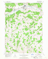
1954 Map of Elkland
USGS Topo · Published 1968About this map
The Cowanesque River valley forms the primary corridor for settlement and industry in this northern Tioga County landscape, dominated by the borough of Elkland and the Baltimore and Ohio Central Railroad. The map reveals the mid-century industrial character of the region, featuring tailing ponds and sewage disposal infrastructure alongside the river. To the south, the terrain rises into upland farming and resource extraction areas, marked by clusters of gas wells near Elbridge. This transition from the rail-serviced valley to the more remote hills of Farmington and Deerfield townships reflects a classic Appalachian pattern of lowland manufacturing and upland agriculture. Family history researchers will find numerous small burial grounds and rural institutions preserved in the landscape, including the Pleasant Valley Cem and the Butler Hill Ch, providing a detailed look at the social geography of the era.
Find a feature on this map
45 named features on this map. Tap any name to fly to it.
Don’t see what you’re looking for? This feature index may not catch every label — zoom into the map to look around manually.
Map Details
Editions of this 1954 Elkland Map
4 editions found
Other maps of this area

1900 · Tioga
USGS Topo · 1:62,500

1900 · Elkland
USGS Topo · 1:62,500

1902 · Tioga
USGS Topo · 1:62,500

1914 · Corning
USGS Topo · 1:62,500

1924 · Woodhull
USGS Topo · 1:48,000

1926 · Woodhull
USGS Topo · 1:62,500

1944 · Woodhull
USGS Topo · 1:62,500

1944 · Corning
USGS Topo · 1:62,500

1950 · Elmira
USGS Topo · 1:250,000

1953 · Woodhull
USGS Topo · 1:24,000