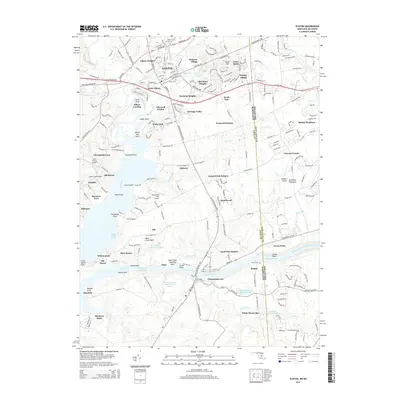
2014 Map of Elkton
USGS Topo · Published 2014About this map
Elkton serves as the focal point of this 2014 survey, illustrating the convergence of major Maryland thoroughfares and the historic Big Elk Creek. The landscape transition from the town's grid to the suburban developments of Windsor Village and Elkwood Estates highlights modern growth patterns near the Delaware state line. Further south, the map documents the engineering of the Chesapeake and Delaware Canal and the Intracoastal Waterway, where Chesapeake City straddles the narrow strip of land between the canal and the Back Creek basin. These waterways represent critical maritime infrastructure connecting the Chesapeake and Delaware Bays. Genealogists and local historians can locate several historic burial grounds, including Elkton Cem, Gilpin Cem, and Bethel Cem, alongside transportation landmarks like the Cecil County Airport and the network of roads branching off W Pulaski Hwy.
Find a feature on this map
95 named features on this map. Tap any name to fly to it.
Don’t see what you’re looking for? This feature index may not catch every label — zoom into the map to look around manually.
Map Details
Editions of this 2014 Elkton Map
This is the sole edition of this map. No revisions or reprints were ever made.
Other maps of this area

1898 · Elkton
USGS Topo · 1:62,500

1899 · Dover
USGS Topo · 1:125,000

1900 · Elkton
USGS Topo · 1:62,500

1900 · Cecilton
USGS Topo · 1:62,500

1904 · Wilmington
USGS Topo · 1:62,500

1906 · Dover
USGS Topo · 1:125,000

1906 · Wilmington
USGS Topo · 1:62,500

1917 · Elkton
USGS Topo · 1:62,500

1919 · Wilmington
USGS Topo · 1:62,500

1920 · Dover
USGS Topo · 1:125,000
Featured Places
- Elkton, MD
- Chesapeake City, MD
- North Chesapeake City, Chesapeake City
- Elkwood Estates, MD
- Brantwood Farms, MD