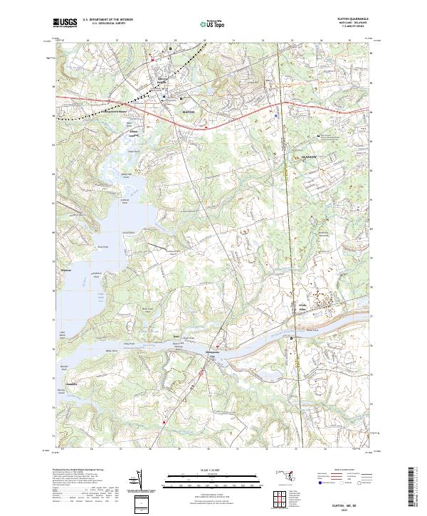
2023 Map of Elkton
USGS Topo · Published 2023About this map
Elkton, the county seat of Cecil County, serves as the primary hub in this detailed survey of the Maryland-Delaware border region. The landscape is defined by the converging waters of Little Elk Creek, Big Elk Creek, and the Elk River, which lead southward toward the vital Chesapeake and Delaware Canal. This waterway remains a centerpiece of the local economy, anchored by the community of Chesapeake City and its Back Creek Mooring Basin.
Find a feature on this map
75 named features on this map. Tap any name to fly to it.
Don’t see what you’re looking for? This feature index may not catch every label — zoom into the map to look around manually.
Map Details
Editions of this 2023 Elkton Map
This is the sole edition of this map. No revisions or reprints were ever made.
Other maps of this area

1898 · Elkton
USGS Topo · 1:62,500

1899 · Dover
USGS Topo · 1:125,000

1900 · Elkton
USGS Topo · 1:62,500

1900 · Cecilton
USGS Topo · 1:62,500

1904 · Wilmington
USGS Topo · 1:62,500

1906 · Dover
USGS Topo · 1:125,000

1906 · Wilmington
USGS Topo · 1:62,500

1917 · Elkton
USGS Topo · 1:62,500

1919 · Wilmington
USGS Topo · 1:62,500

1920 · Dover
USGS Topo · 1:125,000
Featured Places
- Elkton, MD
- Chesapeake City, MD
- North Chesapeake City, Chesapeake City
- Elkwood Estates, MD
- Brantwood Farms, MD