
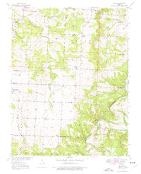
1949 Map of Elkton
USGS Topo · Published 1969About this map
The Pomme De Terre River winds through the eastern portion of this Missouri landscape, while Weaubleau Creek carves its way through the central and western sections. The rural character of mid-century Hickory and Polk counties is evidenced by a dense network of country schools, including Royal Sch, Shady Grove Sch, and Rondo Sch, serving the scattered homesteads and the small settlements of Elkton and Rondo. In the southwest, the St Louis San Francisco railway passes through Flemington, providing a vital transit link for the local economy.
Find a feature on this map
29 named features on this map. Tap any name to fly to it.
Don’t see what you’re looking for? This feature index may not catch every label — zoom into the map to look around manually.
Map Details
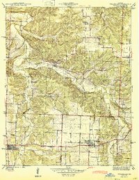
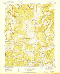
Editions of this 1949 Elkton Map
2 editions found
Other maps of this area

1884 · Bolivar
USGS Topo · 1:125,000

1886 · Stockton
USGS Topo · 1:125,000

1892 · Bolivar
USGS Topo · 1:125,000

1940 · Weaubleau
USGS Topo · 1:24,000

1942 · Elkton
USGS Topo · 1:24,000

1944 · Humansville
USGS Topo · 1:24,000
1944 · Weaubleau
USGS Topo · 1:24,000

1949 · Sentinel
USGS Topo · 1:24,000

1950 · Elkton
USGS Topo · 1:24,000
1950 · Sentinel
USGS Topo · 1:24,000