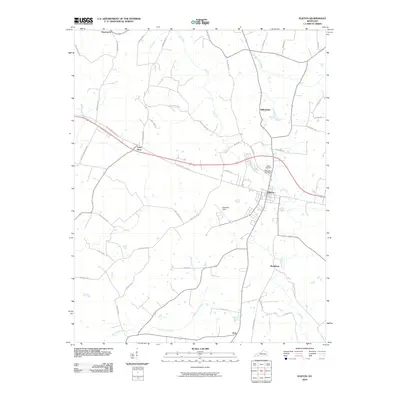
2010 Map of Elkton
USGS Topo · Published 2010About this map
Elkton serves as the central hub of this 2010 study, where the intersection of the Jefferson Davis Hwy and local routes defines the regional movement. The landscape is characterized by a network of agricultural roads and watercourses, including Elk Fork, Whippoorwill Creek, and Reins Lick Creek. Smaller rural nodes like Wilhelmina, Tabernacle, and Tress Shop are scattered across the terrain, reflecting the dispersed settlement patterns typical of southern Kentucky.
Find a feature on this map
43 named features on this map. Tap any name to fly to it.
Don’t see what you’re looking for? This feature index may not catch every label — zoom into the map to look around manually.
Map Details
Editions of this 2010 Elkton Map
This is the sole edition of this map. No revisions or reprints were ever made.
Other maps of this area

1944 · Clarksville
USGS Topo · 1:50,000

1950 · Allensville
USGS Topo · 1:24,000

1950 · Guthrie
USGS Topo · 1:24,000

1950 · Pembroke
USGS Topo · 1:24,000

1950 · Olmstead
USGS Topo · 1:24,000

1951 · Pembroke
USGS Topo · 1:24,000

1951 · Elkton
USGS Topo · 1:24,000

1951 · Olmstead
USGS Topo · 1:24,000

1951 · Hammacksville
USGS Topo · 1:24,000

1952 · Sharon Grove
USGS Topo · 1:24,000