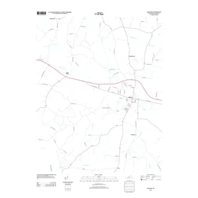
2013 Map of Elkton
USGS Topo · Published 2013About this map
Elkton serves as the central hub of this South Central Kentucky landscape, where the confluence of several local routes meets the winding path of Elk Fork. This 2013 survey illustrates a classic agricultural and small-town pattern, with outlying settlements such as Wilhelmina, Bradshaw, and Tress Shop connected by a network of rural roads like Hadden Mill Rd and Stokes Chapel Rd. The infrastructure of the era is marked by the presence of Standard Field Airport and several historic burial grounds, including Elkton Cem and Glenwood Cem. Waterways like Whippoorwill Cr and Reins Lick Cr define the drainage of the area, cutting through the countryside north and south of the town center. The map documents the persistent layout of these rural communities and family-named landmarks just after the first decade of the millennium.
Find a feature on this map
67 named features on this map. Tap any name to fly to it.
Don’t see what you’re looking for? This feature index may not catch every label — zoom into the map to look around manually.
Map Details
Editions of this 2013 Elkton Map
This is the sole edition of this map. No revisions or reprints were ever made.
Other maps of this area

1944 · Clarksville
USGS Topo · 1:50,000

1950 · Allensville
USGS Topo · 1:24,000

1950 · Guthrie
USGS Topo · 1:24,000

1950 · Pembroke
USGS Topo · 1:24,000

1950 · Olmstead
USGS Topo · 1:24,000

1951 · Pembroke
USGS Topo · 1:24,000

1951 · Elkton
USGS Topo · 1:24,000

1951 · Olmstead
USGS Topo · 1:24,000

1951 · Hammacksville
USGS Topo · 1:24,000

1952 · Sharon Grove
USGS Topo · 1:24,000