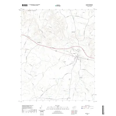
2019 Map of Elkton
USGS Topo · Published 2019About this map
Elkton serves as the focal point of this Todd County landscape, where the confluence of local roads and the Elk Fork creek define the town's geographic footprint. The layout of the community is anchored by the historic Elkton Cem and Glenwood Cem, while the surrounding countryside is dotted with small settlements such as Wilhelmina, Bradshaw, and the curiously named Tress Shop. These peripheral hamlets are connected by an intricate network of rural routes, including Tabernacle Rd and Sharon Grove Rd, which traverse the undulating terrain carved out by waterways like Whippoorwill Cr and Reins Lick Cr.
Find a feature on this map
75 named features on this map. Tap any name to fly to it.
Don’t see what you’re looking for? This feature index may not catch every label — zoom into the map to look around manually.
Map Details
Editions of this 2019 Elkton Map
This is the sole edition of this map. No revisions or reprints were ever made.
Other maps of this area

1944 · Clarksville
USGS Topo · 1:50,000

1950 · Allensville
USGS Topo · 1:24,000

1950 · Guthrie
USGS Topo · 1:24,000

1950 · Pembroke
USGS Topo · 1:24,000

1950 · Olmstead
USGS Topo · 1:24,000

1951 · Pembroke
USGS Topo · 1:24,000

1951 · Elkton
USGS Topo · 1:24,000

1951 · Olmstead
USGS Topo · 1:24,000

1951 · Hammacksville
USGS Topo · 1:24,000

1952 · Sharon Grove
USGS Topo · 1:24,000