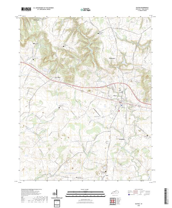
2022 Map of Elkton
USGS Topo · Published 2022About this map
Elkton serves as the central hub of this South-Central Kentucky landscape, anchored by the Todd County Court of Justice. The surrounding countryside is defined by the winding course of the Elk Fork and Whippoorwill Cr, where smaller communities like Wilhelmina and Bradshaw maintain their identities along the rural road network. The map reveals a deeply rooted history through its numerous family and community burial grounds, ranging from the Rose Family Graveyard in the north to the Todd County Meadow Haven Cem in the south near Zion. The inclusion of the North District Amish Church Cem reflects the enduring agricultural and religious character of the region. Transportation remains shaped by historical corridors like the W Jeff Davis Hwy and Russellville Rd, which connect these dispersed settlements across the rolling terrain.
Find a feature on this map
82 named features on this map. Tap any name to fly to it.
Don’t see what you’re looking for? This feature index may not catch every label — zoom into the map to look around manually.
Map Details
Editions of this 2022 Elkton Map
This is the sole edition of this map. No revisions or reprints were ever made.
Other maps of this area

1944 · Clarksville
USGS Topo · 1:50,000

1950 · Allensville
USGS Topo · 1:24,000

1950 · Guthrie
USGS Topo · 1:24,000

1950 · Pembroke
USGS Topo · 1:24,000

1950 · Olmstead
USGS Topo · 1:24,000

1951 · Pembroke
USGS Topo · 1:24,000

1951 · Elkton
USGS Topo · 1:24,000

1951 · Olmstead
USGS Topo · 1:24,000

1951 · Hammacksville
USGS Topo · 1:24,000

1952 · Sharon Grove
USGS Topo · 1:24,000