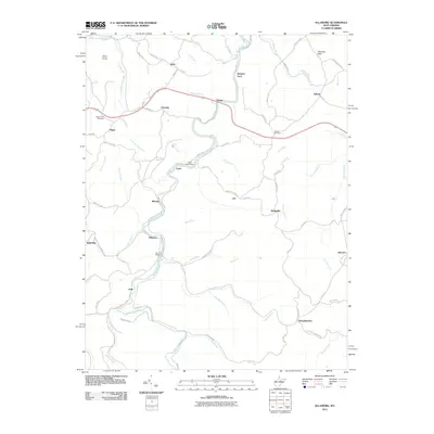
2011 Map of Ellamore
USGS Topo · Published 2011About this map
The Middle Fork River winds through the heart of this Randolph County landscape, serving as the primary geographical axis for small communities like Ellamore, Midvale, and Lantz. This 2011 survey documents a mix of agricultural valley land and forested slopes, where the Weston-Buckhannon-Elkins rail line follows the river's path, connecting industrial and residential hubs. Local history and genealogy interests are well-represented by family-named sites such as Durrett Cemetery and Mount Zion Cemetery, alongside landmarks like the Burnt Bridge and Finegan Ford.
Find a feature on this map
70 named features on this map. Tap any name to fly to it.
Don’t see what you’re looking for? This feature index may not catch every label — zoom into the map to look around manually.
Map Details
Editions of this 2011 Ellamore Map
This is the sole edition of this map. No revisions or reprints were ever made.
Other maps of this area

1886 · St. George
USGS Topo · 1:125,000

1889 · Beverly
USGS Topo · 1:125,000

1891 · St. George
USGS Topo · 1:125,000

1892 · Beverly
USGS Topo · 1:125,000

1893 · Buckhannon
USGS Topo · 1:125,000

1896 · Buckhannon
USGS Topo · 1:125,000

1897 · Buckhannon
USGS Topo · 1:125,000

1904 · Philippi
USGS Topo · 1:62,500

1907 · Belington
USGS Topo · 1:62,500

1909 · Elkins
USGS Topo · 1:62,500