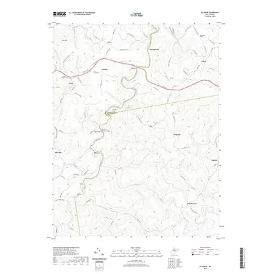
2019 Map of Ellamore
USGS Topo · Published 2019About this map
The Middle Fork River defines the landscape of this region, winding through the borderlands of Barbour, Randolph, and Upshur counties. This rugged terrain is dotted with small rural settlements and homesteads, many connected by historical routes like Us Rte 33 and Talbott Rd. Local history is centered around community hubs such as Ellamore, where the Ellamore School and nearby Spring indicate a once-concentrated township activity. The map reveals a high density of named crossings and hollows, from Finegan Ford to Sand Run, reflecting a topography where watercourses dictated the placement of roads and residences. Genealogists may find interest in several family-named landmarks and cemeteries, including Mount Zion Cem near Vegan and Durrett Cem near Talbott. The presence of the Middle Fork River Trail Bridge near Midvale highlights the intersection of modern recreation with older transit corridors like the Service Run and Devil Run valleys.
Find a feature on this map
102 named features on this map. Tap any name to fly to it.
Don’t see what you’re looking for? This feature index may not catch every label — zoom into the map to look around manually.
Map Details
Editions of this 2019 Ellamore Map
This is the sole edition of this map. No revisions or reprints were ever made.
Other maps of this area

1886 · St. George
USGS Topo · 1:125,000

1889 · Beverly
USGS Topo · 1:125,000

1891 · St. George
USGS Topo · 1:125,000

1892 · Beverly
USGS Topo · 1:125,000

1893 · Buckhannon
USGS Topo · 1:125,000

1896 · Buckhannon
USGS Topo · 1:125,000

1897 · Buckhannon
USGS Topo · 1:125,000

1904 · Philippi
USGS Topo · 1:62,500

1907 · Belington
USGS Topo · 1:62,500

1909 · Elkins
USGS Topo · 1:62,500