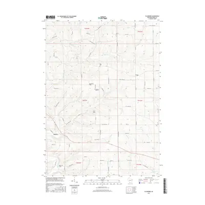
2016 Map of Ellenboro
USGS Topo · Published 2016About this map
The Platte River and its numerous tributaries, including Willow Br and Cannon Br, carve a distinct drainage pattern across this Grant County landscape. The settlement of Ellenboro sits near the river's bend, while the small community of Union occupies the higher ground to the east. This 2016 survey illustrates a rural environment where land use is dictated by the high relief of Buckwheat Ridge, with agricultural fields following the contours of the upland plateaus between deep hollows like Coon Hollow Rd and Dry Hollow Rd. Local history is preserved in several scattered burial sites, including Fairview Cem and Oak Ridge Cem, which serve as landmarks alongside the Martin Fierro Airport. Further south, the Little Platte River and the Baker Ford Bridge mark the transition toward the southern townships.
Find a feature on this map
74 named features on this map. Tap any name to fly to it.
Don’t see what you’re looking for? This feature index may not catch every label — zoom into the map to look around manually.
Map Details
Editions of this 2016 Ellenboro Map
This is the sole edition of this map. No revisions or reprints were ever made.
Other maps of this area

1900 · Lancaster
USGS Topo · 1:125,000

1902 · Mineral Point
USGS Topo · 1:125,000

1904 · Lancaster
USGS Topo · 1:125,000

1908 · Lancaster
USGS Topo · 1:125,000

1952 · Platteville
USGS Topo · 1:24,000

1952 · Rewey
USGS Topo · 1:24,000

1952 · Montfort
USGS Topo · 1:24,000

1957 · Potosi
USGS Topo · 1:24,000

1959 · Dubuque
USGS Topo · 1:250,000

1961 · Dubuque
USGS Topo · 1:250,000