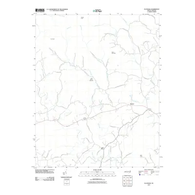
2010 Map of Ellendale
USGS Topo · Published 2010About this map
Ellendale serves as the primary community in this rural Alexander County landscape, situated where local routes meet north of the Middle Little River. The geography is defined by a series of prominent peaks and ridgelines, including Never Mountain, Little Brush Mountain, and Hickory Knob, which separate the various tributaries of the river system. A network of country roads, such as All Healing Springs Rd and Dover Church Rd, connects remote homesteads and valleys. The presence of All Healing Springs suggests a history of mineral springs or local resort activity in the eastern portion of the area. This 2010 digital survey captures the transition from traditional mountain farming toward a landscape of rural residences, preserved by landmarks like Cox Knob and Bald Knob.
Find a feature on this map
64 named features on this map. Tap any name to fly to it.
Don’t see what you’re looking for? This feature index may not catch every label — zoom into the map to look around manually.
Map Details
Editions of this 2010 Ellendale Map
This is the sole edition of this map. No revisions or reprints were ever made.
Other maps of this area

1889 · Wilkesboro
USGS Topo · 1:125,000

1891 · Wilkesboro
USGS Topo · 1:125,000

1895 · Hickory
USGS Topo · 1:125,000

1953 · Charlotte
USGS Topo · 1:250,000

1953 · Winston-Salem
USGS Topo · 1:250,000

1954 · Charlotte
USGS Topo · 1:250,000

1955 · Winston-Salem
USGS Topo · 1:250,000

1960 · Charlotte
USGS Topo · 1:250,000

1962 · Winston-Salem
USGS Topo · 1:250,000

1962 · Charlotte
USGS Topo · 1:250,000