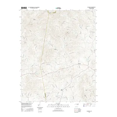
2016 Map of Ellendale
USGS Topo · Published 2016About this map
The Brushy Mountains dominate the northern terrain of this quadrangle, where the borders of Caldwell, Wilkes, and Alexander counties converge. The settlement of Ellendale serves as a central point in a landscape defined by sharp elevation changes and numerous creek drainages. Significant peaks such as Never Mtn, Little Brush Mtn, and Barrett Mtn shape the local geography, while the Middle Little River and the main branch of the Little River wind through the valleys. The road network, including family-named and descriptive routes like Dover Church Rd, Land Cemetery Ln, and Mill Pond Rd, reflects a history of rural mountain development and community clusters. This 2016 survey captures the intricate drainage patterns of Briar Cr, Beaver Cr, and Lambert Fork before they exit the foothills.
Find a feature on this map
103 named features on this map. Tap any name to fly to it.
Don’t see what you’re looking for? This feature index may not catch every label — zoom into the map to look around manually.
Map Details
Editions of this 2016 Ellendale Map
This is the sole edition of this map. No revisions or reprints were ever made.
Other maps of this area

1889 · Wilkesboro
USGS Topo · 1:125,000

1891 · Wilkesboro
USGS Topo · 1:125,000

1895 · Hickory
USGS Topo · 1:125,000

1953 · Charlotte
USGS Topo · 1:250,000

1953 · Winston-Salem
USGS Topo · 1:250,000

1954 · Charlotte
USGS Topo · 1:250,000

1955 · Winston-Salem
USGS Topo · 1:250,000

1960 · Charlotte
USGS Topo · 1:250,000

1962 · Winston-Salem
USGS Topo · 1:250,000

1962 · Charlotte
USGS Topo · 1:250,000