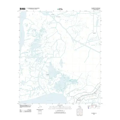
2012 Map of Ellerslie
USGS Topo · Published 2012About this map
The coastal wetlands of St. Mary Parish define this landscape, where the settlements of Ellerslie and South Bend sit protected behind an extensive levee system. This 2012 survey illustrates the critical infrastructure of the region, specifically the W Bayou Sale Levee and E Bayou Sale Levee that guard these communities from the encroaching waters of West Cote Blanche Bay. The area is a complex network of natural bayous and industrial channels, including the Williams Storage Canal and the British-American Canal. Industrial activity is central to the local economy, marked by the expansive Garden City Gas and Oil Field and the Bayou Carlin Oil and Gas Field. From the banks of Bayou Sale to the interior of Fresh Water Lake, the map documents a delicate balance between human settlement, petroleum extraction, and the shifting marshlands of southern Louisiana.
Find a feature on this map
30 named features on this map. Tap any name to fly to it.
Don’t see what you’re looking for? This feature index may not catch every label — zoom into the map to look around manually.
Map Details
Editions of this 2012 Ellerslie Map
This is the sole edition of this map. No revisions or reprints were ever made.
Other maps of this area

1935 · Belle Isle
USGS Topo · 1:31,680

1937 · Bayou Sale
USGS Topo · 1:62,500

1937 · Jeanerette
USGS Topo · 1:62,500

1941 · Belle Isle
USGS Topo · 1:62,500

1945 · New Orleans
USGS Topo · 1:250,000

1948 · Foster
USGS Topo · 1:62,500
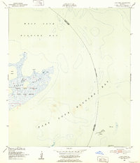
1951 · Lake Point
USGS Topo · 1:24,000

1954 · Jeanerette
USGS Topo · 1:62,500

1954 · Belle Isle
USGS Topo · 1:62,500

1957 · Bayou Sale
USGS Topo · 1:62,500