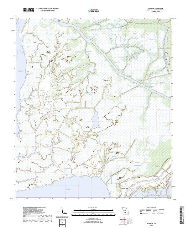
2024 Map of Ellerslie
USGS Topo · Published 2024About this map
The coastal wetlands of St. Mary Parish are defined here by a dense network of natural bayous and industrial waterways. Near the southern edge of the sheet, the settlements of Ellerslie, South Bend, and Albania sit along the Bayou Sale Levee, where the land begins its final transition into the East Cote Blanche Bay. The northern half of the territory is dominated by the Bayou Teche National Wildlife Refuge, a protected landscape interlaced with features like Bayou Portage and Cow Island Bayou.
Find a feature on this map
42 named features on this map. Tap any name to fly to it.
Don’t see what you’re looking for? This feature index may not catch every label — zoom into the map to look around manually.
Map Details
Editions of this 2024 Ellerslie Map
This is the sole edition of this map. No revisions or reprints were ever made.
Other maps of this area

1935 · Belle Isle
USGS Topo · 1:31,680

1937 · Bayou Sale
USGS Topo · 1:62,500

1937 · Jeanerette
USGS Topo · 1:62,500

1941 · Belle Isle
USGS Topo · 1:62,500

1945 · New Orleans
USGS Topo · 1:250,000

1948 · Foster
USGS Topo · 1:62,500
1951 · Lake Point
USGS Topo · 1:24,000

1954 · Jeanerette
USGS Topo · 1:62,500

1954 · Belle Isle
USGS Topo · 1:62,500

1957 · Bayou Sale
USGS Topo · 1:62,500