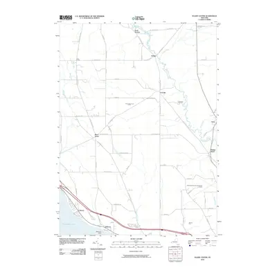
2010 Map of Ellery Center
USGS Topo · Published 2010About this map
Ellery Center serves as a central hub for this portion of Chautauqua County, where a network of rural roads such as Co Touring Rte 44 and Co Touring Rte 380 connect small settlements and agricultural tracts. The landscape is defined by the southeastern shore of Chautauqua Lake at Belleview Point and the meandering path of Cassadaga Creek as it flows past Redbird and Kimball Stand. In the southern portion of the quadrangle, the Chautauqua County-Jamestown Airport and Jamestown Speedway indicate a shift toward more modern infrastructure and recreational land use, while established sites like Peterson Farm maintain the area's rural character. Waterways including Dutch Hollow Creek and Mill Creek drain the surrounding hills, illustrating the local drainage patterns that have influenced settlement at South Stockton and Colburns.
Find a feature on this map
56 named features on this map. Tap any name to fly to it.
Don’t see what you’re looking for? This feature index may not catch every label — zoom into the map to look around manually.
Map Details
Editions of this 2010 Ellery Center Map
This is the sole edition of this map. No revisions or reprints were ever made.
Other maps of this area

1900 · Dunkirk
USGS Topo · 1:62,500

1900 · Cherry Creek
USGS Topo · 1:62,500

1904 · Chautaqua
USGS Topo · 1:62,500

1905 · Jamestown
USGS Topo · 1:62,500

1941 · Cherry Creek
USGS Topo · 1:62,500

1941 · Chautauqua
USGS Topo · 1:62,500

1942 · Jamestown
USGS Topo · 1:62,500

1943 · Dunkirk
USGS Topo · 1:62,500

1954 · Chautauqua
USGS Topo · 1:24,000

1954 · Ellery Center
USGS Topo · 1:24,000