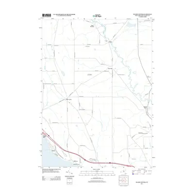
2013 Map of Ellery Center
USGS Topo · Published 2013About this map
Chautauqua Lake dominates the southwestern corner of this topographic study, defining the shorelines near Phillips Mills and Belleview Point. The landscape is characterized by a series of small, dispersed hamlets connected by a network of county routes, including Ellery Center and Towerville. These settlements are situated among various drainages such as Bemus Cr, Dutch Hollow Cr, and Cassadaga Cr, which meander through the terrain. The region maintains a mix of agricultural and industrial land use, evidenced by the Peterson Farm and the Chautauqua County Landfill. Local history and genealogy are preserved in sites like the Red Bird Cem and Gerry Village Cem. Aviation and recreation also leave their mark on the landscape, with the Chautauqua County/Jamestown Airport and the Jamestown Speedway occupying significant acreage in the eastern half of the area.
Find a feature on this map
68 named features on this map. Tap any name to fly to it.
Don’t see what you’re looking for? This feature index may not catch every label — zoom into the map to look around manually.
Map Details
Editions of this 2013 Ellery Center Map
This is the sole edition of this map. No revisions or reprints were ever made.
Other maps of this area

1900 · Dunkirk
USGS Topo · 1:62,500

1900 · Cherry Creek
USGS Topo · 1:62,500

1904 · Chautaqua
USGS Topo · 1:62,500

1905 · Jamestown
USGS Topo · 1:62,500

1941 · Cherry Creek
USGS Topo · 1:62,500

1941 · Chautauqua
USGS Topo · 1:62,500

1942 · Jamestown
USGS Topo · 1:62,500

1943 · Dunkirk
USGS Topo · 1:62,500

1954 · Chautauqua
USGS Topo · 1:24,000

1954 · Ellery Center
USGS Topo · 1:24,000