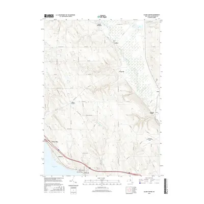
2016 Map of Ellery Center
USGS Topo · Published 2016About this map
Chautauqua Lake defines the southwestern corner of this landscape, where the settlements of Belleview, Driftwood, and Colburns line the shore. Moving inland, the terrain is shaped by a network of waterways including Cassadaga Creek and Dutch Hollow Creek, which carve through the upland areas between Ellery Center and Gerry. This modern-era survey shows a well-established road system, from Old Chautauqua Road in the north to the busy corridors near Kimball Stand. Local heritage is preserved in sites such as Gerry Village Cemetery and Red Bird Cemetery, while the Chautauqua County/Jamestown Airport represents the region's contemporary infrastructure. Small residential clusters like Towerville and Redbird are scattered along rural routes, illustrating the persistent character of these Chautauqua County hamlets.
Find a feature on this map
66 named features on this map. Tap any name to fly to it.
Don’t see what you’re looking for? This feature index may not catch every label — zoom into the map to look around manually.
Map Details
Editions of this 2016 Ellery Center Map
This is the sole edition of this map. No revisions or reprints were ever made.
Other maps of this area

1900 · Dunkirk
USGS Topo · 1:62,500

1900 · Cherry Creek
USGS Topo · 1:62,500

1904 · Chautaqua
USGS Topo · 1:62,500

1905 · Jamestown
USGS Topo · 1:62,500

1941 · Cherry Creek
USGS Topo · 1:62,500

1941 · Chautauqua
USGS Topo · 1:62,500

1942 · Jamestown
USGS Topo · 1:62,500

1943 · Dunkirk
USGS Topo · 1:62,500

1954 · Chautauqua
USGS Topo · 1:24,000

1954 · Ellery Center
USGS Topo · 1:24,000