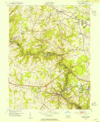
1953 Map of Ellicott City
USGS Topo · Published 1954About this map
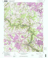
Ellicott City and the steep industrial corridor of the Patapsco River anchor this 1953 survey, illustrating the convergence of milling history and post-war development in Maryland. The river serves as the boundary between Baltimore and Howard counties, winding through the Patapsco State Park and passing active communities like Daniels and Oella. The Baltimore and Ohio railroad tracks trace the water's edge, highlighting the vital transport link that shaped local industry. Education and religious life are prominent, marked by the extensive grounds of Woodstock College and St Marys College.
Find a feature on this map
65 named features on this map. Tap any name to fly to it.
Don’t see what you’re looking for? This feature index may not catch every label — zoom into the map to look around manually.
Map Details
Editions of this 1953 Ellicott City Map
5 editions found
Other maps of this area

1892 · Laurel
USGS Topo · 1:62,500

1892 · Ellicott
USGS Topo · 1:62,500

1894 · Ellicott
USGS Topo · 1:62,500

1894 · Laurel
USGS Topo · 1:62,500

1894 · Baltimore
USGS Topo · 1:62,500

1894 · Relay
USGS Topo · 1:62,500

1897 · Laurel
USGS Topo · 1:62,500

1899 · Baltimore
USGS Topo · 1:62,500

1904 · Baltimore
USGS Topo · 1:62,500

1906 · Ellicott
USGS Topo · 1:62,500