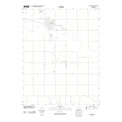
2009 Map of Ellinwood
USGS Topo · Published 2009About this map
The Arkansas River meanders across this Central Kansas landscape, defining the southern edge of the agricultural community of Ellinwood. This 2009 survey documents a town whose grid is deeply influenced by the historic Santa Fe Trail corridor, now reflected in the path of E Santa Fe Ave. The map captures the interface between the urban core and the sprawling prairie, with local landmarks like the Ellinwood Municipal Airport situated northwest of the main settlement and Saint Josephs Cemetery positioned on the town's eastern outskirts. A rigid network of section lines, including E Barton County Rd and numerous numbered avenues such as SE 110 Ave, organizes the surrounding farmland, reflecting the persistent geometry of the Public Land Survey System in the Great Plains.
Find a feature on this map
25 named features on this map. Tap any name to fly to it.
Don’t see what you’re looking for? This feature index may not catch every label — zoom into the map to look around manually.
Map Details
Editions of this 2009 Ellinwood Map
This is the sole edition of this map. No revisions or reprints were ever made.
Other maps of this area

1891 · Great Bend
USGS Topo · 1:125,000

1893 · Great Bend
USGS Topo · 1:125,000

1894 · Lyons
USGS Topo · 1:125,000

1955 · Great Bend
USGS Topo · 1:250,000

1956 · Ellinwood NE
USGS Topo · 1:24,000

1956 · Ellinwood NW
USGS Topo · 1:24,000

1957 · Great Bend
USGS Topo · 1:250,000

1957 · Ellinwood SW
USGS Topo · 1:24,000

1957 · Ellinwood
USGS Topo · 1:24,000

1958 · Great Bend
USGS Topo · 1:250,000