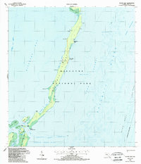
1988 Map of Elliott Key
USGS Topo · Published 1988About this map
Elliott Key serves as the central landmass of Biscayne National Park in this late 20th-century survey, revealing a landscape defined by maritime navigation and conservation. The map details the thin barrier between Biscayne Bay and the Atlantic Ocean, punctuated by specific landings such as University Dock and the Visitor Center near the Campground. The southern end of the sheet transitions into a dense cluster of smaller islands, including Adams Key, Porgy Key, and Rhodes Key, separated by tidal passages like Caesar Creek and Hurricane Creek. Offshore, the survey meticulously records the submerged hazards and landmarks essential to local mariners, from the Ajax Reef and Long Reef to named anchorages like Legare Anchorage. The inclusion of several Trails and a Radio Tower indicates the light human footprint on these keys during this period of federal protection.
Find a feature on this map
49 named features on this map. Tap any name to fly to it.
Don’t see what you’re looking for? This feature index may not catch every label — zoom into the map to look around manually.
Map Details
Editions of this 1988 Elliott Key Map
This is the sole edition of this map. No revisions or reprints were ever made.
Other maps of this area

1948 · Soldier Key
USGS Topo · 1:24,000

1949 · Elliott Key
USGS Topo · 1:24,000

1949 · Card Sound
USGS Topo · 1:24,000

1949 · Pacific Reef
USGS Topo · 1:24,000

1949 · Arsenicker Keys
USGS Topo · 1:24,000

1949 · Perrine
USGS Topo · 1:24,000

1956 · Card Sound
USGS Topo · 1:24,000
1956 · Pacific Reef
USGS Topo · 1:24,000
1956 · Elliott Key
USGS Topo · 1:24,000

1956 · Perrine
USGS Topo · 1:24,000