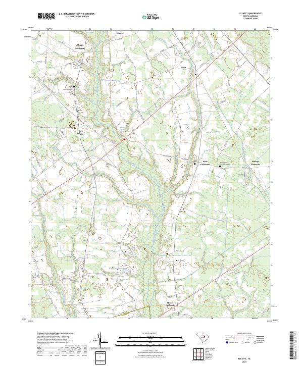
2024 Map of Elliott
USGS Topo · Published 2024About this map
The Black River and its complex system of tributaries, including Nancy Branch and Meadow Branch, form the backbone of this Lee County landscape. This agricultural region is defined by a network of rural hubs, such as St. Charles and the eponymous town of Elliott, which serve as anchors for the surrounding farmsteads. For genealogists and local historians, the map identifies several significant burial sites and landmarks, notably the Mount Zion Church Graveyard and Mount Pleasant Church Graveyard. The terrain is also dotted with numerous small water bodies like Minnie Deschamps Pond and Turners Pond, illustrating the importance of local hydrology to the area's development. The transition from natural watercourses to managed systems is evident in features like the Atkins Drainage Canal near Dunlape Crossroads. This record of the South Carolina lowcountry reflects a persistent pattern of rural crossroads settlements, including English Crossroads and Rhodes Crossroads, that have shaped the local identity for generations.
Find a feature on this map
84 named features on this map. Tap any name to fly to it.
Don’t see what you’re looking for? This feature index may not catch every label — zoom into the map to look around manually.
Map Details
Editions of this 2024 Elliott Map
This is the sole edition of this map. No revisions or reprints were ever made.
Other maps of this area

1920 · Mayesville
USGS Topo · 1:48,000

1921 · Mayesville
USGS Topo · 1:62,500

1941 · Spartanburg
USGS Topo · 1:250,000

1943 · Mayesville
USGS Topo · 1:62,500

1946 · Sumter
USGS Topo · 1:62,500

1953 · Spartanburg
USGS Topo · 1:250,000

1954 · Augusta
USGS Topo · 1:250,000

1957 · Sumter East
USGS Topo · 1:24,000

1957 · Ashwood
USGS Topo · 1:62,500

1957 · Sumter
USGS Topo · 1:62,500
Featured Places
- English Crossroads, SC
- Rhodes Crossroads, SC
- Dunlape Crossroads, SC
- Wells Crossroads, SC
- Saint Charles, SC