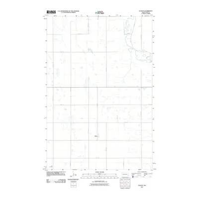
2011 Map of Elliott
USGS Topo · Published 2011About this map
Elliott serves as the primary hub of this Ransom County landscape, situated amidst a grid of section-line roads and numerous small prairie potholes. The Sheyenne River cuts through the northeastern corner, its winding course and associated Valley Rd providing the only significant deviation from the township-and-range geometry that defines the region. For those researching local families, the Dick Cemetery is a notable landmark in the southwest, anchoring the map's genealogical interest. The area's character is defined by this intersection of water and transport, where the river's path meets the rigid orientation of corridors like Elliott Rd and 124th Ave SE, reflecting the deep-seated agricultural layout of the North Dakota plains in the early twenty-first century.
Find a feature on this map
17 named features on this map. Tap any name to fly to it.
Don’t see what you’re looking for? This feature index may not catch every label — zoom into the map to look around manually.
Map Details
Editions of this 2011 Elliott Map
This is the sole edition of this map. No revisions or reprints were ever made.
Other maps of this area

1897 · Tower
USGS Topo · 1:125,000

1953 · Fargo
USGS Topo · 1:250,000

1956 · Fargo
USGS Topo · 1:250,000

1957 · Elliott SW
USGS Topo · 1:24,000

1957 · Elliott SE
USGS Topo · 1:24,000
1962 · Englevale
USGS Topo · 1:24,000

1962 · Lisbon
USGS Topo · 1:24,000

1962 · Lisbon SW
USGS Topo · 1:24,000

1962 · Elliott
USGS Topo · 1:24,000

1967 · Ft. Ransom
USGS Topo · 1:24,000