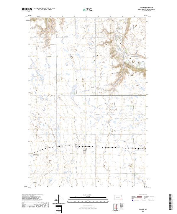
2024 Map of Elliott
USGS Topo · Published 2024About this map
The Elliott township area in Ransom County is defined by a landscape transitioning from the flat agricultural plains of eastern North Dakota toward the more varied terrain near the Sheyenne River. In the southwestern corner of the quadrangle, the Dick Cem stands as a focal point for genealogical research, situated amidst a systematic grid of section roads like 122nd Ave SE and 71st SE. The settlement of Elliott itself occupies a central position within the township, serving as the primary hub for this rural community. The northeastern portion of the map reveals the winding path of the Sheyenne River, where the elevation contours tighten, contrasting with the expansive wetlands and small ponds scattered throughout the prairie to the west.
Find a feature on this map
23 named features on this map. Tap any name to fly to it.
Don’t see what you’re looking for? This feature index may not catch every label — zoom into the map to look around manually.
Map Details
Editions of this 2024 Elliott Map
This is the sole edition of this map. No revisions or reprints were ever made.
Other maps of this area

1897 · Tower
USGS Topo · 1:125,000

1953 · Fargo
USGS Topo · 1:250,000

1956 · Fargo
USGS Topo · 1:250,000

1957 · Elliott SW
USGS Topo · 1:24,000

1957 · Elliott SE
USGS Topo · 1:24,000
1962 · Englevale
USGS Topo · 1:24,000

1962 · Lisbon
USGS Topo · 1:24,000

1962 · Lisbon SW
USGS Topo · 1:24,000

1962 · Elliott
USGS Topo · 1:24,000

1967 · Ft. Ransom
USGS Topo · 1:24,000