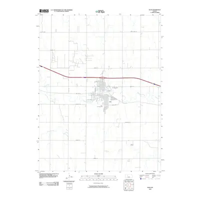
2009 Map of Ellis
USGS Topo · Published 2009About this map
Big Creek flows through the heart of Ellis, Kansas, framing a landscape defined by its grid-patterned streets and agricultural surroundings. This 2009 survey highlights the town's local landmarks, including Saint Marys Cemetery and Mount Hope Cemetery, which serve as significant sites for genealogical research. The presence of Ellis Landing Field to the south and the Pleasant Oil Field in the southeastern portion of the quadrangle points to the region's diverse economic activities, from aviation to energy extraction.
Find a feature on this map
31 named features on this map. Tap any name to fly to it.
Don’t see what you’re looking for? This feature index may not catch every label — zoom into the map to look around manually.
Map Details
Editions of this 2009 Ellis Map
This is the sole edition of this map. No revisions or reprints were ever made.
Other maps of this area

1893 · Ellis
USGS Topo · 1:125,000

1893 · Hill
USGS Topo · 1:125,000

1896 · Hays
USGS Topo · 1:125,000

1896 · Plainville
USGS Topo · 1:125,000

1955 · Great Bend
USGS Topo · 1:250,000

1955 · Beloit
USGS Topo · 1:250,000

1957 · Great Bend
USGS Topo · 1:250,000

1958 · Great Bend
USGS Topo · 1:250,000

1959 · Beloit
USGS Topo · 1:250,000

1961 · Yocemento
USGS Topo · 1:24,000