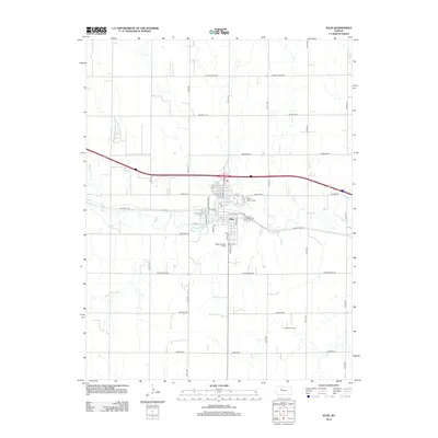
2012 Map of Ellis
USGS Topo · Published 2012About this map
Ellis stands as a central hub on the High Plains, where the winding course of Big Cr meets a grid of rural section roads and modern transportation corridors. This 2012 survey illustrates the town's layout between the interstate and the historic route of Old US Hwy 40, which parallels the local street grid. Local history is anchored by the presence of Saint Mary's Cem and Mount Hope Cem, while the town's aviation history is represented by the Ellis Landing Field to the south. Beyond the residential core, the landscape transitions into a working landscape of extraction and agriculture, marked by the Pleasant Oil Field and numerous rural arteries such as Fairgrounds Rd and Airbase Rd. The map provides a clear look at the intersection of water resources like Spring Cr and the heavy infrastructure required for Kansas's energy and transit economies.
Find a feature on this map
40 named features on this map. Tap any name to fly to it.
Don’t see what you’re looking for? This feature index may not catch every label — zoom into the map to look around manually.
Map Details
Editions of this 2012 Ellis Map
This is the sole edition of this map. No revisions or reprints were ever made.
Other maps of this area

1893 · Ellis
USGS Topo · 1:125,000

1893 · Hill
USGS Topo · 1:125,000

1896 · Hays
USGS Topo · 1:125,000

1896 · Plainville
USGS Topo · 1:125,000

1955 · Great Bend
USGS Topo · 1:250,000

1955 · Beloit
USGS Topo · 1:250,000

1957 · Great Bend
USGS Topo · 1:250,000

1958 · Great Bend
USGS Topo · 1:250,000

1959 · Beloit
USGS Topo · 1:250,000

1961 · Yocemento
USGS Topo · 1:24,000