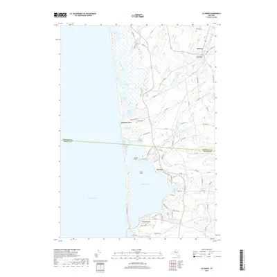
2019 Map of Ellisburg
USGS Topo · Published 2019About this map
Lake Ontario defines the western edge of this coastal landscape, where a complex network of barrier ponds and marshes creates a distinctive interface between land and water. The northern reaches near Ellisburg are characterized by the meandering South Sandy Creek and the South Sandy Creek Bridge, which support the inland agricultural community. Moving south, the shoreline is punctuated by a string of significant water bodies including Lakeview Pond, Goose Pond, and the North and South Colwell Ponds.
Find a feature on this map
80 named features on this map. Tap any name to fly to it.
Don’t see what you’re looking for? This feature index may not catch every label — zoom into the map to look around manually.
Map Details
Editions of this 2019 Ellisburg Map
This is the sole edition of this map. No revisions or reprints were ever made.
Other maps of this area

1893 · Sackets Harbor
USGS Topo · 1:62,500

1895 · Sacketts Harbor
USGS Topo · 1:62,500

1895 · Stony Island
USGS Topo · 1:62,500

1895 · Pulaski
USGS Topo · 1:62,500

1942 · Stony Point
USGS Topo · 1:31,680

1942 · Sandy Creek
USGS Topo · 1:24,000

1943 · Henderson
USGS Topo · 1:31,680

1943 · Pulaski
USGS Topo · 1:31,680

1943 · Richland
USGS Topo · 1:31,680

1943 · Texas
USGS Topo · 1:31,680