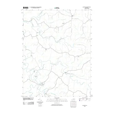
2010 Map of Elliston
USGS Topo · Published 2010About this map
Eagle Creek carves a winding path through the heart of this North Central Kentucky landscape, creating the distinctive Horseshoe Bend as it flows past Downingsville. This 2010 survey illustrates a rural region defined by its narrow ridges and deep creek valleys, where small settlements like Mount Zion, Delia, and Twin Bridges are connected by a network of winding roads following the topography. Genealogists and local historians will find significant detail in the family-named burial grounds dotting the hills, including Webster Cemetery, Sipple Cemetery, and the New Vine Run Cemetery.
Find a feature on this map
48 named features on this map. Tap any name to fly to it.
Don’t see what you’re looking for? This feature index may not catch every label — zoom into the map to look around manually.
Map Details
Editions of this 2010 Elliston Map
This is the sole edition of this map. No revisions or reprints were ever made.
Other maps of this area

1943 · Patriot
USGS Topo · 1:24,000

1950 · Mason
USGS Topo · 1:24,000

1950 · Glencoe
USGS Topo · 1:24,000

1950 · Elliston
USGS Topo · 1:24,000

1950 · Williamstown
USGS Topo · 1:24,000

1950 · Owenton
USGS Topo · 1:24,000

1950 · Verona
USGS Topo · 1:24,000

1950 · Walton
USGS Topo · 1:24,000

1950 · Lawrenceville
USGS Topo · 1:24,000
1951 · Patriot
USGS Topo · 1:24,000