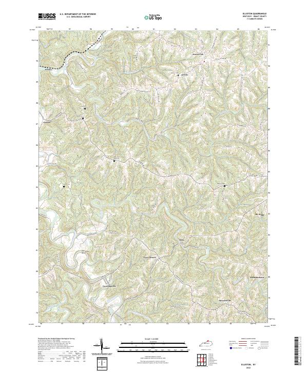
2022 Map of Elliston
USGS Topo · Published 2022About this map
Arnolds Creek and Eagle Creek carve a winding path through this corner of northern Kentucky, defining a landscape of sharp ridges and deep hollows. The settlement pattern follows these high points, with crossroads communities like Four Corners and Downingsville established along the ridgetop roads. This modern survey captures the enduring rural character of the region, where family-named landmarks and small burial grounds like Delf Cem and Sipple Cem remain central to the local geography. Significant water features including Ten Mile Creek and the dramatic loop at Horseshoe Bend illustrate the complex drainage network that has historically dictated travel and farming. The presence of multiple ridgetop cemeteries such as New Vine Run Cem and Pettit Cem serves as a vital record for genealogists tracing legacy families in the vicinity of Elliston and Stewartsville.
Find a feature on this map
73 named features on this map. Tap any name to fly to it.
Don’t see what you’re looking for? This feature index may not catch every label — zoom into the map to look around manually.
Map Details
Editions of this 2022 Elliston Map
This is the sole edition of this map. No revisions or reprints were ever made.
Other maps of this area

1943 · Patriot
USGS Topo · 1:24,000

1950 · Mason
USGS Topo · 1:24,000

1950 · Glencoe
USGS Topo · 1:24,000

1950 · Elliston
USGS Topo · 1:24,000

1950 · Williamstown
USGS Topo · 1:24,000

1950 · Owenton
USGS Topo · 1:24,000

1950 · Verona
USGS Topo · 1:24,000

1950 · Walton
USGS Topo · 1:24,000

1950 · Lawrenceville
USGS Topo · 1:24,000
1951 · Patriot
USGS Topo · 1:24,000