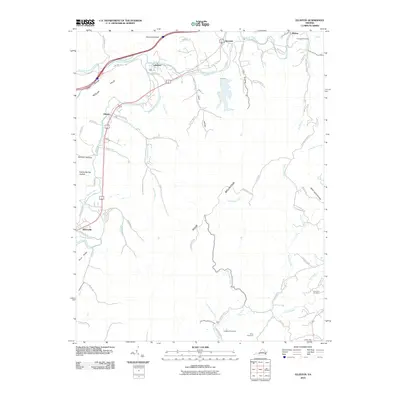
2010 Map of Elliston
USGS Topo · Published 2010About this map
The Roanoke River forks into its northern and southern branches in this corner of Roanoke County, shaping a corridor of settlements that include Lafayette, Elliston, and Shawsville. The landscape is dominated by the massive presence of Poor Mountain and Bent Mountain, which direct the flow of numerous tributaries such as Bottom Creek and Mill Creek. This 2010 survey reflects a region defined by its narrow valleys and steep ridges, where historical homesteads and family burial grounds remain nestled in the hollows. Genealogists can identify several local landmarks including Duckwiller Cemetery near Wabun and the Lawrence Cemetery further south. The transportation network, including Northfork Rd and Pedlar Rd, follows the natural contours of the Pedlar Hills and River Ridge, tracing the same paths that have connected these mountain communities for generations.
Find a feature on this map
69 named features on this map. Tap any name to fly to it.
Don’t see what you’re looking for? This feature index may not catch every label — zoom into the map to look around manually.
Map Details
Editions of this 2010 Elliston Map
This is the sole edition of this map. No revisions or reprints were ever made.
Other maps of this area

1890 · Christiansburg
USGS Topo · 1:125,000

1923 · Waiteville
USGS Topo · 1:62,500

1929 · Salem
USGS Topo · 1:48,000

1931 · Waiteville
USGS Topo · 1:48,000

1932 · Salem
USGS Topo · 1:62,500

1932 · Blacksburg
USGS Topo · 1:48,000

1937 · Blacksburg
USGS Topo · 1:62,500

1944 · Waiteville
USGS Topo · 1:62,500

1950 · Elliston
USGS Topo · 1:62,500

1951 · Waiteville
USGS Topo · 1:62,500