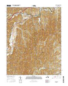
2016 Map of Elliston
USGS Topo · Published 2016About this map
The confluence of the North Fork Roanoke River and South Fork Roanoke River forms the upper Roanoke River in this section of Southwest Virginia. This drainage basin defines the local geography, anchoring the settlements of Elliston, Lafayette, and Shawsville. To the east, the Spring Hollow Reservoir sits tucked into the rising slopes of the Pedlar Hills, providing a major water feature for the region. The map highlights the transition from the valley floor to the high elevations of Poor Mtn, with the southernmost corner crossed by the Blue Ridge Parkway. Local genealogy and land history are preserved through several family-named burial sites, including Duckwiller Cem, Craighead Cem, and King Cem. The road network, including the historic Roanoke Rd, traces the same paths through the hollows that have served these mountain communities for generations.
Find a feature on this map
81 named features on this map. Tap any name to fly to it.
Don’t see what you’re looking for? This feature index may not catch every label — zoom into the map to look around manually.
Map Details
Editions of this 2016 Elliston Map
This is the sole edition of this map. No revisions or reprints were ever made.
Other maps of this area

1890 · Christiansburg
USGS Topo · 1:125,000

1923 · Waiteville
USGS Topo · 1:62,500

1929 · Salem
USGS Topo · 1:48,000

1931 · Waiteville
USGS Topo · 1:48,000

1932 · Salem
USGS Topo · 1:62,500

1932 · Blacksburg
USGS Topo · 1:48,000

1937 · Blacksburg
USGS Topo · 1:62,500

1944 · Waiteville
USGS Topo · 1:62,500

1950 · Elliston
USGS Topo · 1:62,500

1951 · Waiteville
USGS Topo · 1:62,500