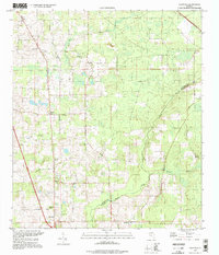
1994 Map of Ellisville
USGS Topo · Published 1998About this map
Olustee Creek meanders along the boundary of Columbia and Union Counties, defining the southeastern landscape of this Florida region. The area is characterized by scattered rural settlements such as Ellisville, Mason, and Myrtis, which are linked by a network of local roads including Old Haltiwanger Road and Payne Road. This 1990s-era survey reveals a community deeply rooted in its local landmarks and spiritual centers, evidenced by numerous burial grounds and houses of worship like Hopeful Ch Cemetery, Everybodys Tabernacle, and New Zion Church. To the west, Mt Tabor rises near the Mt Tabor Church, while the northern reaches feature the Rose Creek Lookout Tower overlooking Rose Creek. The integration of traditional family-named cemeteries such as Parnell Cemetery and Kerce Cemetery alongside the winding course of Swifts Creek provides a detailed view of the rural heritage of the Florida interior.
Find a feature on this map
30 named features on this map. Tap any name to fly to it.
Don’t see what you’re looking for? This feature index may not catch every label — zoom into the map to look around manually.
Map Details
Editions of this 1994 Ellisville Map
This is the sole edition of this map. No revisions or reprints were ever made.
Other maps of this area

1954 · Gainesville
USGS Topo · 1:250,000

1954 · Valdosta
USGS Topo · 1:250,000

1958 · Valdosta
USGS Topo · 1:250,000

1958 · Gainesville
USGS Topo · 1:250,000

1959 · Valdosta
USGS Topo · 1:250,000

1959 · Gainesville
USGS Topo · 1:250,000

1962 · Lake City East
USGS Topo · 1:24,000

1962 · Mikesville
USGS Topo · 1:24,000

1963 · Olustee
USGS Topo · 1:24,000

1963 · Ellisville
USGS Topo · 1:24,000