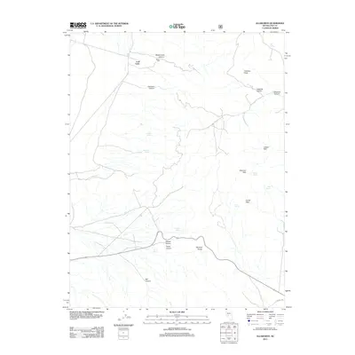
2011 Map of Ellsworth
USGS Topo · Published 2011About this map
Lodi Tanks anchors this corner of the Paradise Range in Nevada, where the desert landscape is defined by its vital water sources and dramatic elevation changes. The high points of Fairview Peak and Sherman Peak overlook a network of seasonal drainages and named canyons, including Marble Falls Canyon and Germany Canyon. These landforms dictate the historical movement through the area, channeled through gaps like Camel Pass. Isolated springs such as Big Spring, Rock Spring, and Ottawa Spring appear as critical survival markers in an otherwise arid environment. The presence of Lodi Tank suggests the importance of water catchment for early cattle ranching or mining operations that once sought a foothold in this part of Nye County. The terrain transitions from the high peaks down into Lebeau Park, offering a clear view of the geographical constraints that shaped settlement and land use in this Great Basin region.
Find a feature on this map
25 named features on this map. Tap any name to fly to it.
Don’t see what you’re looking for? This feature index may not catch every label — zoom into the map to look around manually.
Map Details
Editions of this 2011 Ellsworth Map
This is the sole edition of this map. No revisions or reprints were ever made.
Other maps of this area

1907 · Tonopah
USGS Topo · 1:250,000

1908 · Tonopah
USGS Topo · 1:250,000

1948 · Paradise Peak
USGS Topo · 1:62,500

1948 · Ione
USGS Topo · 1:62,500

1950 · Paradise Peak
USGS Topo · 1:62,500

1950 · Ione
USGS Topo · 1:62,500

1955 · Millett
USGS Topo · 1:250,000

1956 · South Shoshone Peak
USGS Topo · 1:62,500

1956 · Tonopah
USGS Topo · 1:250,000

1959 · Tonopah
USGS Topo · 1:250,000