2022 Map of Ellsworth
USGS Topo · Published 2022About this map
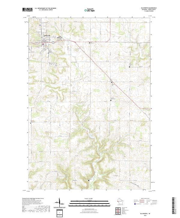
The Pierce County Courthouse stands as the central landmark of the county seat, where the urban grid of Ellsworth transitions into the hills of western Wisconsin. This landscape is defined by the winding course of Isabelle Cr and the prominent elevation of Ulvin Hill. The area shows a high density of rural religious and burial sites, reflecting the tight-knit pioneer communities that established Clayfield Catholic Cem, Zion Covenant Cem, and the Old Clayfield Cem along the plateau roads.
Find a feature on this map
76 named features on this map. Tap any name to fly to it.
Don’t see what you’re looking for? This feature index may not catch every label — zoom into the map to look around manually.
Map Details
Editions of this 2022 Ellsworth Map
This is the sole edition of this map. No revisions or reprints were ever made.