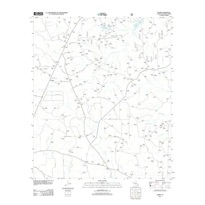
2012 Map of Elmer
USGS Topo · Published 2012About this map
Valentine Lake and the southern edge of Kincaid Reservoir anchor the water-rich geography of this Rapides Parish region. The landscape is characterized by a dense network of creek branches, including Dyer Cr, Stracener Br, and Big Brushy Cr, which drain the timbered terrain. Small rural communities and postal hubs such as Otis, Lewiston, and Elmer PO are connected by a web of Forest Routes and local roads, illustrating the area's ongoing integration with the surrounding National Forest land.
Find a feature on this map
69 named features on this map. Tap any name to fly to it.
Don’t see what you’re looking for? This feature index may not catch every label — zoom into the map to look around manually.
Map Details
Editions of this 2012 Elmer Map
This is the sole edition of this map. No revisions or reprints were ever made.
Other maps of this area

1932 · Boyce SW
USGS Topo · 1:31,680

1937 · Chopin SE
USGS Topo · 1:31,680

1941 · Boyce
USGS Topo · 1:62,500

1943 · Leander
USGS Topo · 1:62,500

1944 · Chopin
USGS Topo · 1:62,500

1945 · Boyce SE
USGS Topo · 1:31,680

1948 · Chopin
USGS Topo · 1:62,500

1949 · Boyce SE
USGS Topo · 1:31,680

1953 · Alexandria
USGS Topo · 1:250,000
1954 · Leander
USGS Topo · 1:62,500