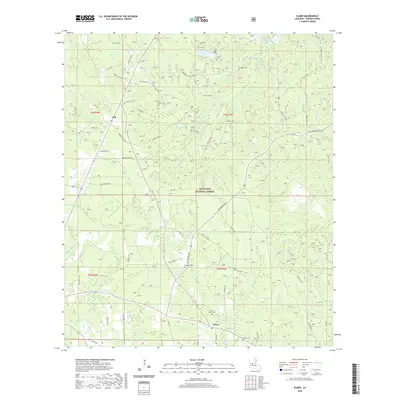
2020 Map of Elmer
USGS Topo · Published 2020About this map
The Kisatchie National Forest covers much of this Rapides Parish landscape, where the settlements of Otis and Elmer are connected by a network of forest routes and parish roads. This area is defined by its complex hydrology, with numerous drainages like Big Brushy Cr, Spring Cr, and Bill Cr feeding into larger bodies such as Valentine Lake and the corner of Kincaid Lake.
Find a feature on this map
76 named features on this map. Tap any name to fly to it.
Don’t see what you’re looking for? This feature index may not catch every label — zoom into the map to look around manually.
Map Details
Editions of this 2020 Elmer Map
This is the sole edition of this map. No revisions or reprints were ever made.
Other maps of this area

1932 · Boyce SW
USGS Topo · 1:31,680

1937 · Chopin SE
USGS Topo · 1:31,680

1941 · Boyce
USGS Topo · 1:62,500

1943 · Leander
USGS Topo · 1:62,500

1944 · Chopin
USGS Topo · 1:62,500

1945 · Boyce SE
USGS Topo · 1:31,680

1948 · Chopin
USGS Topo · 1:62,500

1949 · Boyce SE
USGS Topo · 1:31,680

1953 · Alexandria
USGS Topo · 1:250,000
1954 · Leander
USGS Topo · 1:62,500