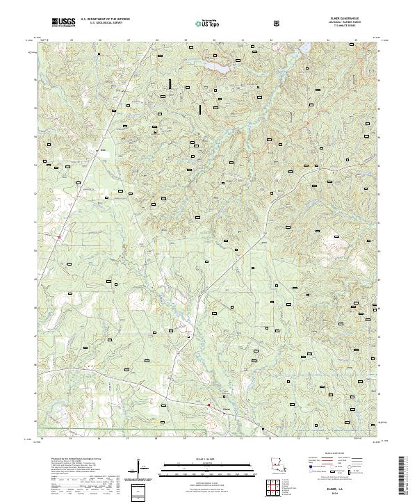
2024 Map of Elmer
USGS Topo · Published 2024About this map
Elmer and Otis serve as the primary focal points in this central Louisiana landscape, where the dense timberlands of the Kisatchie National Forest meet a network of small family cemeteries and creek drainages. Genealogists can identify several local burial sites, including Saint Peter Cem, Rougeau Cem, and Dyer Cem, which are scattered among the ridges between Valentine Creek and Spring Creek. The transport pattern is defined by a web of forest routes and local roads such as Walker Cutoff Rd and State Rte 1199, reflecting the area's ongoing management for timber and rural residence. The terrain is deeply dissected by a high density of watercourses, from the Little Brushy Creek in the east to Parks Creek in the northwest, illustrating the complex hydrology of the Rapides Parish piney woods.
Find a feature on this map
75 named features on this map. Tap any name to fly to it.
Don’t see what you’re looking for? This feature index may not catch every label — zoom into the map to look around manually.
Map Details
Editions of this 2024 Elmer Map
This is the sole edition of this map. No revisions or reprints were ever made.
Other maps of this area

1932 · Boyce SW
USGS Topo · 1:31,680

1937 · Chopin SE
USGS Topo · 1:31,680

1941 · Boyce
USGS Topo · 1:62,500

1943 · Leander
USGS Topo · 1:62,500

1944 · Chopin
USGS Topo · 1:62,500

1945 · Boyce SE
USGS Topo · 1:31,680

1948 · Chopin
USGS Topo · 1:62,500

1949 · Boyce SE
USGS Topo · 1:31,680

1953 · Alexandria
USGS Topo · 1:250,000
1954 · Leander
USGS Topo · 1:62,500