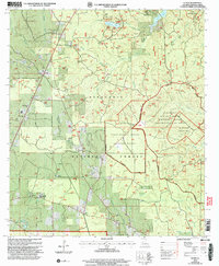
2003 Map of Elmer
USGS Topo · Published 2005About this map
Kisatchie National Forest dominates this landscape in Rapides Parish, where managed timberlands and federal reserves converge with rural communities. The map highlights the extensive Palustris Experimental Forest (Johnson Tract), a site dedicated to silvicultural research, alongside the restricted Claiborne Air-To-Ground Weapons Range. These large institutional tracts are punctuated by local landmarks that reveal the area's social fabric, such as Oak Hill High Sch and several country churches including Fellowship Ch and St Clair Ch.
Find a feature on this map
39 named features on this map. Tap any name to fly to it.
Don’t see what you’re looking for? This feature index may not catch every label — zoom into the map to look around manually.
Map Details
Editions of this 2003 Elmer Map
This is the sole edition of this map. No revisions or reprints were ever made.
Other maps of this area

1932 · Boyce SW
USGS Topo · 1:31,680

1937 · Chopin SE
USGS Topo · 1:31,680

1941 · Boyce
USGS Topo · 1:62,500

1943 · Leander
USGS Topo · 1:62,500

1944 · Chopin
USGS Topo · 1:62,500

1945 · Boyce SE
USGS Topo · 1:31,680

1948 · Chopin
USGS Topo · 1:62,500

1949 · Boyce SE
USGS Topo · 1:31,680

1953 · Alexandria
USGS Topo · 1:250,000
1954 · Leander
USGS Topo · 1:62,500