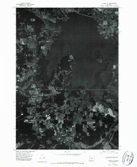
1975 Map of Elmira SE
USGS Topo · Published 1979About this map
Fern Ridge Reservoir dominates this orthophotoquad, its wide waters and complex shoreline defining the eastern portion of the map. This 1975 aerial perspective reveals the developing landscape of Lane County, where the growing settlement of Veneta sits at a crossroads of residential expansion and timber-rich terrain. To the north, the community of Elmira is visible amidst a mosaic of cleared fields and dense woodlands, illustrating the mid-seventies transition from traditional rural agriculture to more suburbanized patterns. The map captures distinct geographical markers within the reservoir itself, such as Gibson Island, and shows the organized layout of smaller residential pockets like Maywood. Because this is an orthophotograph, researchers can observe the actual density of forest cover and the precise footprint of individual structures during this era of Oregon's development.
Find a feature on this map
5 named features on this map. Tap any name to fly to it.
Don’t see what you’re looking for? This feature index may not catch every label — zoom into the map to look around manually.
Map Details
Editions of this 1975 Elmira SE Map
This is the sole edition of this map. No revisions or reprints were ever made.
Other maps of this area

1909 · Elmira
USGS Topo · 1:62,500

1910 · Eugene
USGS Topo · 1:62,500

1921 · Cottage Grove
USGS Topo · 1:62,500

1922 · Elmira
USGS Topo · 1:62,500

1940 · Eugene
USGS Topo · 1:62,500

1942 · Elmira
USGS Topo · 1:62,500

1942 · Crow
USGS Topo · 1:62,500

1945 · Crow
USGS Topo · 1:62,500

1946 · Eugene
USGS Topo · 1:62,500

1949 · Eugene
USGS Topo · 1:62,500