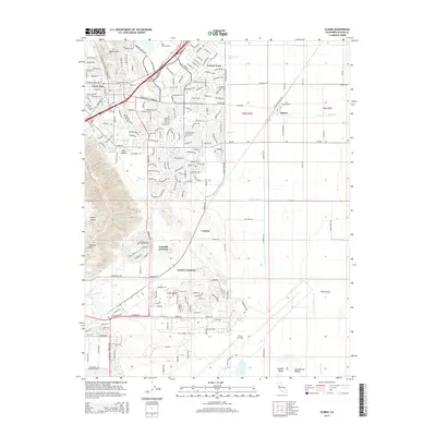
2015 Map of Elmira
USGS Topo · Published 2015About this map
Elmira and its surrounding Solano County landscape appear in this modern survey at a point of significant residential expansion and aviation importance. The map documents the dense suburban footprint of Leisure Town and Ulatis Park alongside established landmarks like the Vacaville-Elmira Cemetery. The transition from the elevations of the English Hills and Cement Hill in the west down toward the Sacramento Valley floor is marked by a complex network of waterways, including Ulatis Cr, Alamo Cr, and Barker Slough.
Find a feature on this map
91 named features on this map. Tap any name to fly to it.
Don’t see what you’re looking for? This feature index may not catch every label — zoom into the map to look around manually.
Map Details
Editions of this 2015 Elmira Map
This is the sole edition of this map. No revisions or reprints were ever made.
Other maps of this area

1896 · Carquinez Strait
USGS Topo · 1:62,500

1898 · Karquines
USGS Topo · 1:62,500

1901 · Karquines
USGS Topo · 1:62,500

1902 · Napa
USGS Topo · 1:125,000

1907 · Antioch
USGS Topo · 1:62,500

1908 · Vacaville
USGS Topo · 1:62,500

1908 · Antioch
USGS Topo · 1:62,500

1916 · Dixon
USGS Topo · 1:31,680

1916 · Maine Prairie
USGS Topo · 1:31,680

1917 · Wolfskill
USGS Topo · 1:31,680